The Meteorology, Climatology and Geophysics Agency (BMKG) has issued a warning for extreme weather from March 18-20, 2025, on Monday (17/3/2025) evening. The warning of increased rainfall to heavy rain and high waves for various regions follows the appearance of Tropical Cyclone Seed 91S in the Indian Ocean south of West Java and Madden-Julian Oscillation (MJO) activity.
On 18th-20th March 2025, according to the BMKG official website, it is predicted that a number of Indonesian regions will receive moderate to very heavy rain.
For people who are in disaster-prone areas to remain always vigilant to the impact of extreme weather that has the potential to occur.
As reported by Detiknews, BMKG Head Dwikorita Karnawati said that although Tropical Cyclone 91S does not have a high potential to become a tropical cyclone in the next 24 hours, its impact appears in various regions.
“To the local government, we hope that this early warning can be responded to and heeded, and immediately take anticipatory steps. Coordination with related agencies, such as the Regional Disaster Management Agency (BPBD), is very important to ensure that mitigation efforts are effective and a quick response can be made in the event of a disaster,” Dwikorita said.
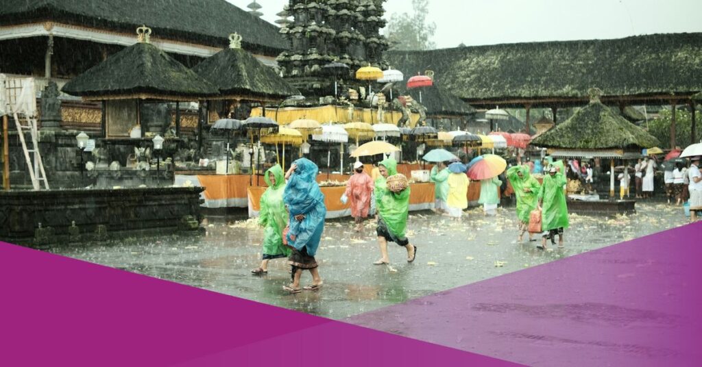
In Bali, East and West Nusa Tenggara, BMKG warns of light rain in Denpasar and thunderstorms in Mataram and Kupang.
All major cities in eastern Indonesia also have the potential for rain on March 18, 2025. Meanwhile, Jakarta, Bandung, and Semarang may see light rain, while Serang and Yogyakarta could experience moderate rain. In Surabaya, thunderstorms are anticipated.
Beware of High Waves in Bali
The Denpasar Meteorology Climatology and Geophysics Center (BBMKG) estimates that the height of sea waves in the southern waters of Bali and the Lombok Strait reaches up to three meters and the Bali Strait reaches 2.5 meters.
The Bali region is also expected to still have the potential for light to moderate intensity rain in most areas of the Island of the Gods. While the wind blows from the southwest-west with an estimated speed of up to 30 kilometers per hour.
The public is advised to be aware of the impact of extreme weather including floods, landslides, and falling trees.
Extreme Weather Tips
The following are tips to be aware of floods, heavy rains, high waves, strong winds, and landslides from BMKG:
- Clean the waterways
- Prepare a disaster emergency bag
- Keep important items in a safe place
- Do not go to sea in risky areas
- Stay away from big trees
- Stay away from billboards
- Be aware of strong winds and landslides if you live in a hilly area.
- Monitor weather info on the InfoBMKG website, app, and social media.
For local governments:
– Coordinate with disaster mitigation-related agencies such as the Regional Disaster Management Agency (BPBD).
– Clean drainage and waterways to reduce flood risk
– Socialization to residents
– Take anticipatory steps against the potential hydrometeorological disasters above.