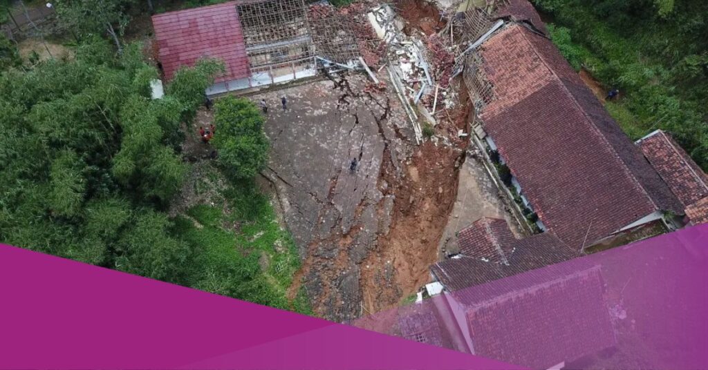
A land shift struck Cigombong Village in West Bandung Regency on Thursday, 29th February 2024, destroying four houses and significant damage to a school. Responding swiftly, the National Disaster Management Agency evacuated all residents to the Rongga Islamic Center in West Bandung Regency.
The threat of land shift in Bandung remains, putting an additional 20 houses at risk. Yan Cahya Djuarsa, Head of the Emergency and Logistics Division of West Bandung Regency, disclosed that the current count of displaced individuals stands at 192. The financial toll of this disaster is substantial, with losses amounting to hundreds of millions, impacting essential public facilities like mosques, village roads, and integrated service post units.
According to the mapping findings by the Center for Volcanology and Geological Disaster Mitigation (PVMBG), the land movement in Cigombong Village was induced by the geological characteristics and structures of the land.
“The rock composition in this area is a blend of sandstone and siltstone, possessing a clayey texture. Consequently, when exposed to water, the rock becomes easily displaced, especially considering the relatively steep slope,” elucidated Yuhandi Kristiawan, an Earth Researcher from the PVMBG, on Tuesday, 5th March 2024.
Furthermore, the substantial rainfall intensity experienced over the past month also contributed to the occurrence of the land shift. As reported by members of the village community, initial cracks were observed at various locations on 18th February 2024, which subsequently expanded, culminating in the land shift disaster on 29th February.
Yuhandi Kristiawan further underscored that, based on preliminary findings, the susceptibility level in the area ranges from medium to high. Consequently, the area remains at risk of potential further landslides. The public must remain vigilant, await updated information from pertinent authorities, and monitor any physical indicators within their vicinity.


